A second strong atmospheric river reached Southern California on Sunday bringing intense rainfall and posing a significant risk of dangerous flooding, as described by the National Weather Service’s Los Angeles office. This along with expected snowfall in the mountains, led Governor Gavin Newsom to announce a state of emergency in eight counties including Los Angeles and Orange. Subsequently Los Angeles and San Bernardino counties also declared states of emergency.
“Lindsey P. Horvath, Chair of the Los Angeles County Board of Supervisors emphasized the county’s proactive measures to safeguard our communities during the storm and to address any consequences that may arise.”
Officials clarified that the emergency proclamation would facilitate the swift acquisition of crucial supplies and resources the mobilization of disaster service workers and the implementation of emergency protective measures including evacuation directives. Meanwhile the Los Angeles office of the weather service issued a Flash Flood Warning early Monday for various areas, including the Santa Monica Mountains, Hollywood Hills, Griffith Park, adjacent foothills in the valleys and specific cities like Malibu and Beverly Hills in southwestern California. The warning was in effect until 900 AM PST Monday and highlighted the occurrence of numerous damaging landslides and flooded roadways as of 1138 PM PST.
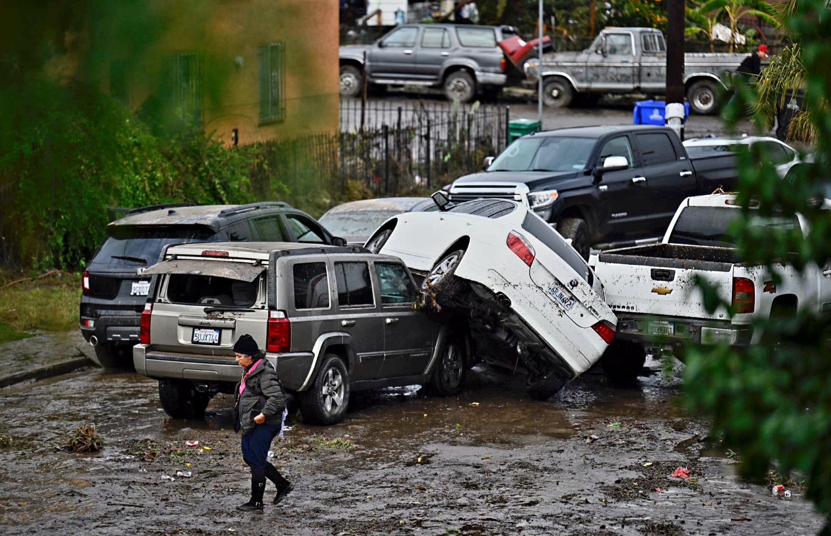
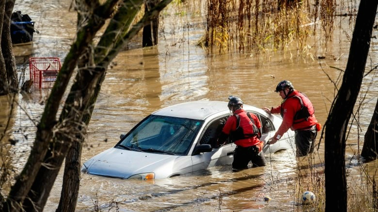
Ongoing incidents of submerged vehicles, flooded creeks and streams persist in the warned area as indicated by Doppler radar detecting heavy rainfall across the affected region.
Additionally the L.A. office issued a flood watch extending until 4 p.m. Tuesday emphasizing the “HIGH RISK FOR LIFE-THREATENING AND DAMAGING FLOODING” in capital letters.
Previously the office described the weather conditions as “one of the most dramatic in recent memory” emphasizing the system’s danger to life and property with major risks. Once more capital letters were used to underscore the severity of the situation.
On X, the social media platform formerly known as Twitter, the office issued a warning early Monday morning, alerting to an “EXTREMELY DANGEROUS SITUATION” unfolding in the Hollywood Hills area and around the Santa Monica Mountains. They highlighted the risk of life-threatening landslides and anticipated additional flash flooding overnight urging people to avoid travel if possible with capital letters used for emphasis.
The San Bernardino County Fire Department reported rescuing three individuals from swift waters. The department reassured that there were no injuries but all individuals were being assessed for hypothermia.

On Sunday evening, the city of Torrance issued a flood warning, alerting residents to the imminent or ongoing occurrence of debris flows. Urgent measures were advised to safeguard lives and property, including avoiding unnecessary travel.
According to the National Weather Service (NWS) rainfall is anticipated to persist until Tuesday with the highest accumulations projected for L.A. County. Estimates suggest 4 to 8 inches in the metropolitan area and 8 to 14 inches in mountainous and foothill regions. Given the prolonged heavy rainfall, authorities have recommended remote work arrangements where feasible.
In the early hours of Monday the weather service highlighted the lingering impact of a potent atmospheric river storm predicting a continuation of heavy rain and snow mainly affecting LA County until Tuesday. Expectations for dangerous flooding in L.A. County were emphasized alongside the likelihood of significant mountain snowfall until tonight with the storm gradually subsiding by Tuesday. Following this intermittent showers are anticipated from Wednesday through Friday, accompanied by cooler temperatures compared to usual.
Additionally the storm set a new record on Sunday, with downtown L.A. experiencing 4.10 inches of rainfall surpassing the previous daily record of 2.55 inches set in 1927, as reported by the weather service.
Furthermore reported that over 600,000 homes and businesses in California were without power in the early hours of Monday.
Mayor Karen Bass emphasized during an afternoon news briefing that while storms can rapidly evolve, it’s essential to convey the gravity of the current weather event. She underscored the potential for this storm to become historic warning of severe winds, thunderstorms, and the possibility of brief tornadoes.
California flood Watch remains in effect
A flood watch persisted across all regions with meteorologists cautioning about potential flooding on highways and residential areas posing risks even to parked vehicles due to the anticipated heavy rainfall. Commuters are advised to steer clear of freeways on Monday morning.

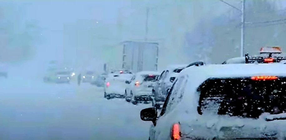
Meanwhile the National Weather Service (NWS) has issued a rare winter storm warning for Ventura County and areas extending northward, including the mountainous regions of San Bernardino and Riverside counties such as Big Bear City, Big Bear Lake, Running Springs, and Wrightwood. This alert signifies the likelihood of excessive rainfall leading to flash flooding.
Although Los Angeles County is not under a storm warning it remains under a gale warning signaling the possibility of sustained surface winds or frequent gusts ranging between 39 mph to 54 mph. Wind intensity is expected to diminish on Monday and Tuesday with the potential for stronger winds resurfacing by Wednesday.