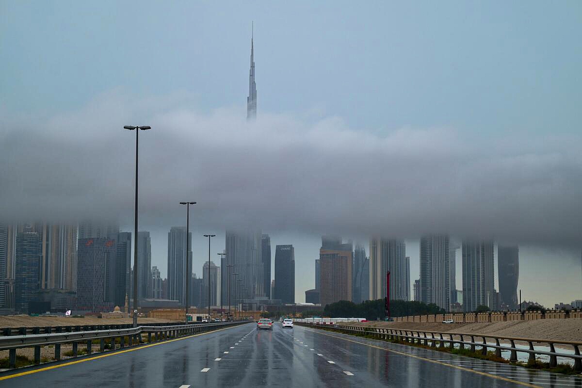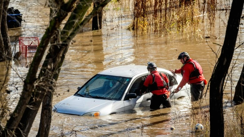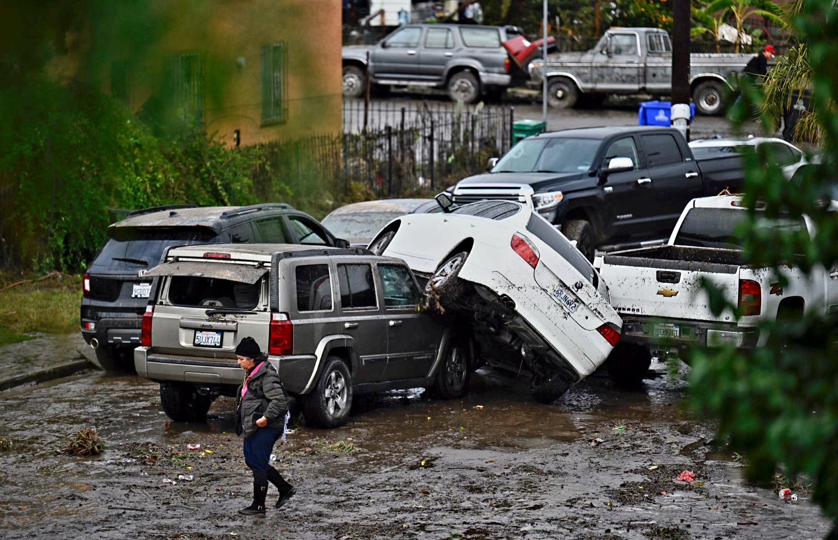
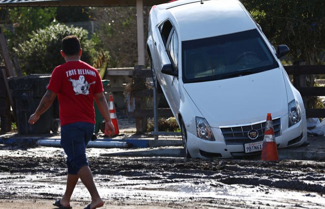
For the second time within a month Southern California witnessed a resurgence of torrential flooding this time affecting San Diego a city renowned for its nearly flawless weather. Unprecedented rainfall attributed to El Niño-fueled storms from the Pacific Ocean led to one of San Diego’s wettest days on record. Responding to the crisis California Governor Gavin Newsom and Mayor Todd Gloria issued emergency declarations as heavy downpours resulted in raging rivers stranded motorists and washed away vehicles.
Climate scientists emphasize that such extreme weather events are becoming more frequent nationwide attributing this trend to the warming climate and oceans enabling the atmosphere to hold greater amounts of moisture. The phenomenon is anticipated to persist in the years ahead. When coupled with the elevated temperatures and abnormal sea levels associated with El Niño California’s coastal regions become particularly vulnerable creating a potential recipe for disaster.
The convergence of warmer atmospheric conditions and El Niño’s influence contributes to the intensified and more frequent occurrences of devastating rainfall underscoring the urgency for proactive measures in the face of ongoing climate challenges.
Table of Contents
San Diego faced an unexpected deluge this week with the origin of the intense rainfall traced to powerful weather systems impacting the region.
This week’s deluge in San Diego was the result of an atmospheric river a meteorological phenomenon characterized by a plume of moisture extending over vast distances. These “rivers in the sky” transported moist air from the tropics northeastward culminating in record-breaking rain and consequential flooding. Notably the atmospheric river traversed a region with sea temperatures 5.4 degrees warmer than usual including pockets reaching approximately 7.5 degrees above normal.
Martin Ralph the director of the Center for Western Weather and Water Extremes at the Scripps Institution of Oceanography emphasized that this alignment significantly amplified the atmospheric river’s impact supercharging both moisture and heat. Comparisons were drawn to a similar storm event in Santa Barbara during the 1998 El Niño but with water temperatures then only around 3.6 degrees above normal.
The consequences of this weather event were pronounced with Monday marking San Diego’s wettest January day on record. San Diego International Airport recorded 2.73 inches of rain ranking as the fourth wettest day in the city’s weather history spanning 174 years. In the hills and mountains east of San Diego reports indicated up to 5 inches of rainfall over a 72-hour period underlining the severity and extent of the precipitation.
How climate change makes worse rainfall ?
The recent intensification of events like the notable rainstorm in San Diego is attributed to climate change as explained by UCLA climate scientist Daniel Swain. He emphasizes that the warming atmosphere associated with climate change enables it to hold more moisture rendering storms approximately 10% wetter than they would be otherwise. While this percentage might seem modest the consequential increase in precipitation has the potential to overwhelm storm drainage systems not designed to accommodate such heightened water volumes.
Swain further illustrates that cities equipped with more robust infrastructure such as Miami or Houston would likely experience fewer disruptions even with a comparable amount of rainfall. This underscores the critical role of urban planning and adaptation strategies in mitigating the impacts of extreme weather events exacerbated by climate change.
Moreover Swain notes the correlation between the recent rainstorm and the typical weather pattern associated with El Niño. This connection highlights the complex interplay between natural climate variability and the additional stressors induced by a changing climate. Understanding these dynamics is crucial for both short-term response efforts and long-term climate resilience planning in regions vulnerable to such events.
Other areas also hit by damaging floods recently.
In December Ventura County faced intense rain prompting water rescues and evacuations with rain rates exceeding 3 inches per hour. These incidents align with a pattern of increasingly severe rainstorms linked to climate warming as noted by climate scientists. The system responsible for San Diego’s recent heavy rain also contributed to storms in the South and similar events occurred in 2023 in Fort Lauderdale Florida and Vermont.
The global scale of these catastrophes is underscored by John Dickson president and CEO of Aon Edge a private flood insurance provider. Dickson reveals that 70% of recent worldwide catastrophes involved flooding making it the most widespread and devastating natural catastrophe. This trend is driven by unprecedented rainfall and coastal flooding emphasizing the broader impact of climate-induced extreme weather events beyond specific regions.
Alex Tardy the warning coordination meteorologist for the weather service in San Diego highlights the current inconsistency in weather models. While early February shows indications of an active Pacific jet stream details about the specific areas along the coast facing the most significant impacts remain uncertain. The weather service has issued a general warning of increased rainfall emphasizing the challenge in pinpointing precise outcomes at this stage.
California faces mounting flooding risks
Southern California faced flooding last August due to Hurricane Hilary bringing record-breaking rainfall. The San Diego Regional Climate Collaborative and others predict more frequent extreme rainfall events as temperatures rise even amid prolonged and intensified drought periods. Long-term climate studies indicate fewer days with moderate rainfall but the top 1% of wettest days becoming significantly wetter creating longer dry spells between more substantial rain events.
Notably these impactful “events” are atmospheric rivers according to Martin Ralph director of the Center for Western Weather and Water Extremes. Climate studies project a 20% increase in atmospheric rivers’ role in annual precipitation along the Pacific Coast with these rivers already contributing 30-50% of yearly rainfall. As climate change progresses atmospheric rivers are expected to produce even more rain highlighting the evolving challenges and risks posed by changing precipitation patterns.
Scientists have previously raised concerns about the potential for mega-floods in California as the climate continues to warm. Scientists including Martin Ralph from Scripps are working to understand atmospheric rivers and their correlation with the El Niño/La Niña oscillation’s impact on Pacific coast rainfall. Scripps in collaboration with NOAA and the U.S. Air Force Reserve is conducting exploratory flights to improve atmospheric river forecasts addressing the complexities of these weather phenomena occurring in both oscillation phases.
El Niño marked by warmer waters along the equator influences California’s climate with wetter-than-normal conditions. It also contributes to powerful surf and elevated sea levels along the coast. This winter sea levels are approximately four inches higher with a continued upward trend noted Dan Rudnick a Scripps professor of physical oceanography.
Anticipating future coastal impacts scientists predict a rise in overall sea levels and increased vulnerability due to sinking land in certain areas. San Diego’s sea levels have already increased about six inches in the past century and by 2050 California’s sea levels are projected to rise between 0.5 and 1.2 feet as indicated in the California Sea Level Rise report.